


Golf course CARTOGRAPHY & PHOTOGRAMMETRY In this project, we conducted a detailed analysis using photogrammetry and advanced cartography of a golf course. Using drones equipped with high-precision sensors, we generated 3D terrain models, topographic maps, and elevation maps, providing a detailed visualization of the terrain morphology. This work was key to optimizing the design and [...]
Category Archives: GEOMATICS AND TOPOGRAPHY
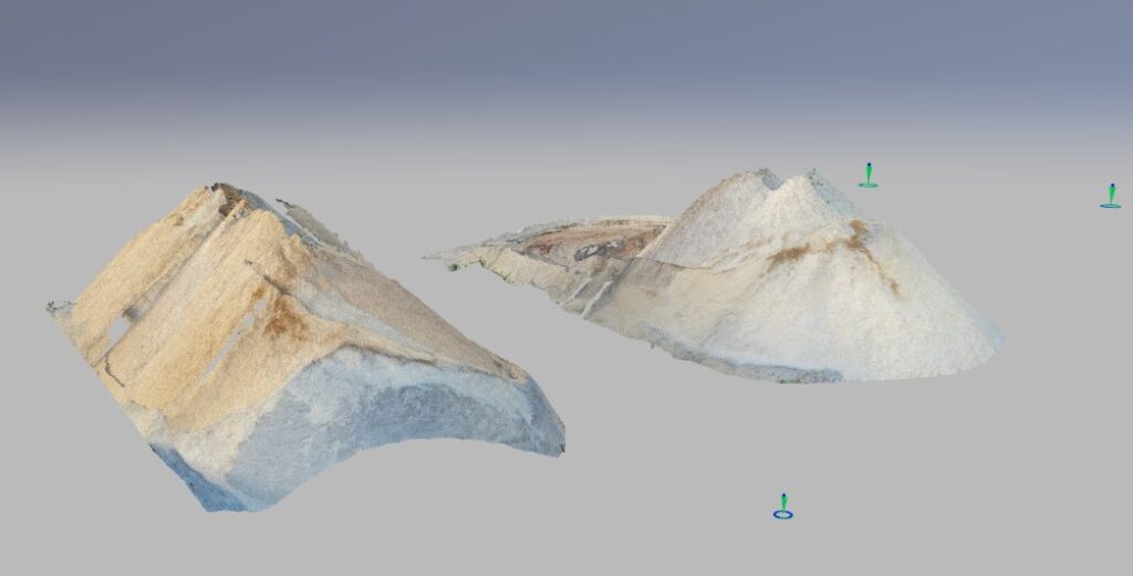
Volumetric calculation of sawdust and wood stockpiles VOLUMETRIC CALCULATION Volumetric calculation of sawdust and wood stockpiles In this project, we conducted a detailed analysis using aerial photogrammetry for the volumetric calculation of sawdust and wood stockpiles in industrial facilities. By utilizing drones equipped with high-precision sensors, we generated high-resolution orthomosaics and digital surface models (DSM) [...]

Road mapping CARTOGRAPHY AND PHOTOGRAMMETRY Mountain road topography and mapping In this project, advanced photogrammetry and cartography techniques were used to conduct a detailed analysis of the infrastructure and surrounding terrain. Using drones equipped with high-resolution cameras, precise images were captured, allowing for the creation of digital terrain models of the study area. The analysis [...]

Infrastructure inspection CONSTRUCTION MONITORING AND PROJECT In this project, we inspected infrastructures to assess damage caused by environmental wear and to efficiently manage biomass. We used drones equipped with advanced technology to evaluate the condition of structures affected by environmental degradation. This includes the inspection of bridges and other infrastructures exposed to adverse conditions. Through [...]
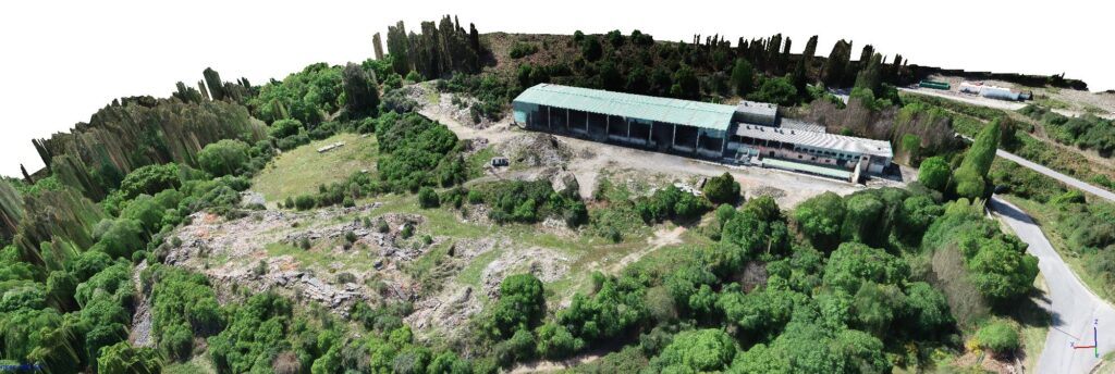
Warehouse and surroundings remodeling CONSTRUCTION MONITORING AND PROJECT Abandoned warehouse and land remodeling The study area corresponds to an abandoned industrial warehouse surrounded by debris and scattered vegetation, making it difficult to accurately assess the terrain for future remodeling. Using drones and point cloud technology, a detailed analysis was carried out to identify accumulated debris [...]
