

Mountain road topography and mapping
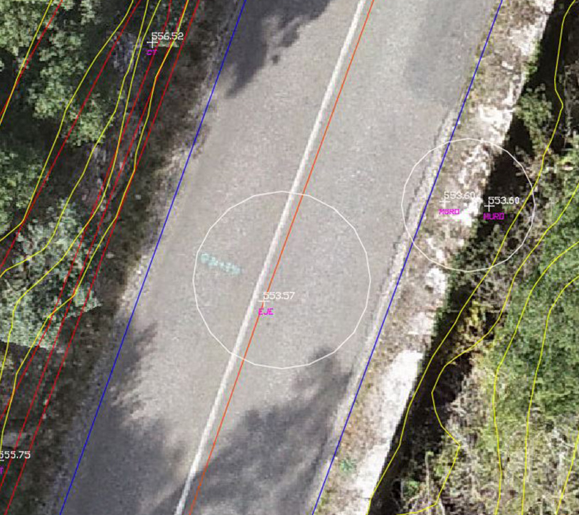
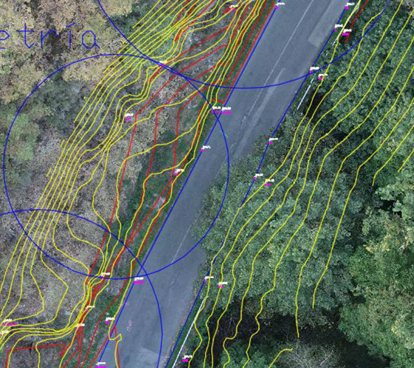
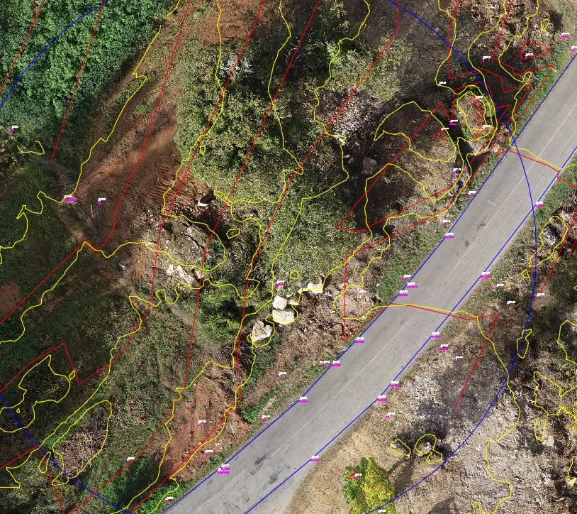
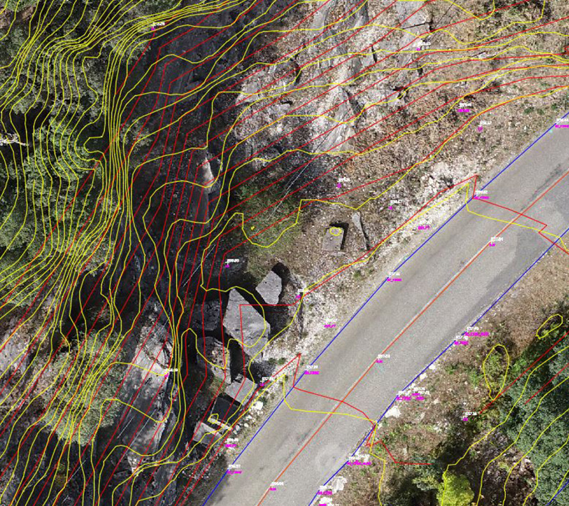
In this project, advanced photogrammetry and cartography techniques were used to conduct a detailed analysis of the infrastructure and surrounding terrain. Using drones equipped with high-resolution cameras, precise images were captured, allowing for the creation of digital terrain models of the study area. The analysis included the evaluation of slopes, elevations, and the terrain contour mapping. The generated data was crucial for planning new interventions, both in terms of infrastructure development and environmental improvements.
These types of solutions are ideal for restoration projects, road planning, and other infrastructure developments, providing work teams with detailed information for accurate decision-making.
Need accurate maps and detailed data for your projects?
Optimize land planning and management with our advanced cartography and photogrammetry services. Contact us now!
